

A new paper published today in the journal Nature reveals that human land-use activity has begun to change the regional water and energy cycles –– the interplay of air coming in from the Atlantic Ocean, water transpiration by the forest, and solar radiation –– of parts of the Amazon basin. In addition, it shows that ongoing interactions of deforestation, fire, and climate change have the potential to alter carbon storage, rainfall patterns and river discharge on an even larger basinwide scale.
The research was led by the Woods Hole Research Center (WHRC), with contributions from UC Santa Barbara's National Center for Ecological Analysis and Synthesis (NCEAS). Lead scientist Eric Davidson of WHRC, and 13 Brazilian and U.S. colleagues from universities, government, and non-governmental organizations, all of whom participated in the Large-Scale Biosphere-Atmosphere Experiment in the Amazon, produced a framework by which the connections among climate change, agricultural expansion, logging, and fire risk can be evaluated. The framework considers changes in greenhouse-gas emissions, and energy and water cycles. Using it, they found signs of transition to a disturbance-dominated regime in the southern and eastern portions of the Amazon basin.
Jennifer K. Balch, postdoctoral associate at NCEAS and co-author of the study, said: "One strong sign of a new disturbance regime is the high number of recent large-scale wildfires, which are a byproduct of intentional fires in Brazil's ‘arc of deforestation.' These fires are extremely frequent, occurring every few years, compared with every couple centuries in the past."
Why is this important? Humans have been part of the Amazon basin forest-river system for thousands of years, but the expansion and intensification of agriculture, logging, and urban development –– and their synergistic impacts –– are beginning to stress the natural integrity of the ecosystem. Since the Amazon River produces about 20 percent of the world's fresh water discharge, and the Amazon forest holds about 100 billion metric tons of carbon (10 years' worth of global fossil fuel emissions), it is important that economic development in the region proceed along sustainable paths that do not degrade the ecosystem services provided to local, regional and global communities by the forests and rivers of the region.
"The studies in this review document changes in river flow, sedimentation in rivers, and lengthening of the dry season in the southern and eastern flanks of the Amazon Basin," Davidson said. "Whether similar changes are likely to occur in other parts of the basin will depend on the interplay of management decisions and the impacts of climate change during the next few years and decades."
The project showed that the Amazon forest is resilient to considerable climatic variation from year to year, but that this resilience can be exceeded by severe or prolonged drought. The evidence points to a system in biophysical transition, highlighting the need for improved understanding of the trade-offs among land cover, carbon stocks, water resources, habitat conservation, human health, and economic development in future scenarios of climate change and land-use change.
Efforts in Brazil to curb deforestation have led to a significant decline in the clearing of forests in the Amazon basin, from nearly 28,000 square kilometers per year in 2004 to less than 7,000 square kilometers in 2010; but, at the same time, the incidence of fire has not decreased, indicating continued risks for forest degradation through climate-fire interactions.
For example, Balch said, "In 1997-98, during the drought associated with an El Niño event, 39,000 square kilometers of intact Amazon forest burned. That's twice the area annually deforested in Brazil between 1988-2005."
With Brazil poised to become a major economic power, the study emphasizes that improvements in scientific and technological capacity, and human resources will be required to guide and manage future sustainable development in the region.
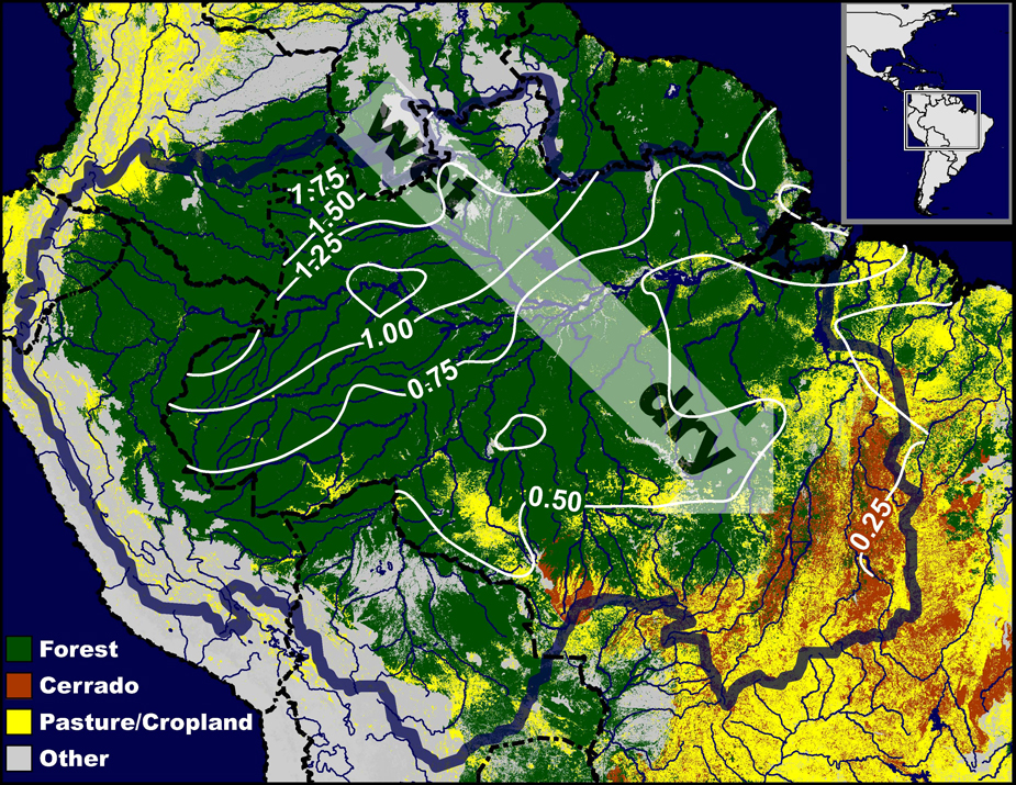
† Top image: A thick blue line demarcates the hydrologic Amazon basin; isopleths of mean daily precipitation during the driest months of the year are overlaid onto four land-cover classes. The arrow emphasizes the trend from continuously wet conditions in the northwest to long pronounced dry seasons in the southeast.
Credit: Paul A. Lefebvre
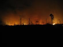
†† Middle image: Cattle-pasture fire burning through the night in Mato Grosso, Brazil, in the southern Amazon in 2006.
Credit: Jennifer K. Balch, NCEAS
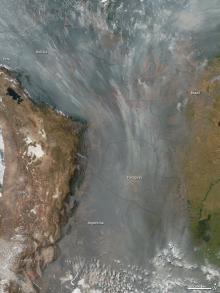
††† Bottom image: More than 140,000 fires were detected on Aug. 23, 2010, in this NASA image that spans 2,500 kilometers across southern Latin America, including Brazil, Bolivia, Argentina, Peru, Chile, and Paraguay.
Credit: Jeff Schmaltz, NASA
Related Links
National Center for Ecological Analysis and Synthesis
Woods Hole Research Center
Nature


