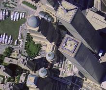
With its vast collection of maps and globes, millions of aerial photographs and satellite images, and files of digital geospatial data, the Map and Imagery Laboratory at UC Santa Barbara offers more geographical information than Google Earth. The Lab's resources and technologies integrate diverse information formats to track changes over time in geographic areas of the planet.
Larry Carver and Mary Larsgaard will lead a virtual tour of the collections at a UCSB Affiliates Town Forum titled "The Earth at Your Fingertips: UCSB's Map and Imagery Laboratory" on Tuesday, February 24. Carver recently retired as director of library technologies and digital initiatives, and Larsgaard is director of the UCSB Map and Imagery Laboratory.
Their presentation begins at 7:30 p.m. at First Presbyterian Church Fellowship Hall, 21 E. Constance Ave. Admission is $8 for UCSB Affiliates, alumni, or Chancellor's Council members and $10 for all others. Advance registration is recommended by calling the UCSB Office of Community Relations at (805) 893-4388.
Users of the laboratory's collections include geologists tracking earthquake faults, attorneys settling property disputes, environmentalists monitoring pollution, and public health officials tracking disease. They are used also by biologists, historians, archaeologists, land-use planners, engineers.
The recently acquired Citipix Collection, aerial photographs of major metropolitan areas, presents a pictorial odyssey of the United States at the turn of the 21st century.
Carver began work with maps in the UCSB library in the late 1960's, when the collection was composed of 300 maps and two five-drawer map cases. As the collection grew, so did Carver's reputation in the remote-sensing and map-library worlds. For his seminal role in collecting and preserving our digital heritage, the Library of Congress has named Carver "Pioneer of Digital Preservation." Although retired, he continues to work part-time to obtain and administer contracts and grants dealing with digital geospatial data.
Larsgaard has published extensively in the field of geospatial data in libraries, most notably with her widely used text, "Map Librarianship: An Introduction." Her areas of expertise are cataloging/metadata creation, and 20th-century or more recent topographic and geologic maps. She holds master's degrees in geography and library science from the University of Oregon and the University of Minnesota, respectively.
Related Links
UCSB Office of Community Relations
UCSB Map and Imagery Laboratory


